We’ve made several improvements in the latest betas, here’s some highlights:
Photos & Attachments
There’s a new “attachments” field type which lets you attach photos and any other files to locations in your collections. If it’s a photo that has a GPS location, Maparoni will use that to put it in the right place, too. Use the accompanying photo(...) formula to display a thumbnail directly on the map, or click the attachment in the locations details to preview it with QuickLook — you can even use Markup to crop or scribble on them, or use a formula like photo(...).fill(green) to tint the images.
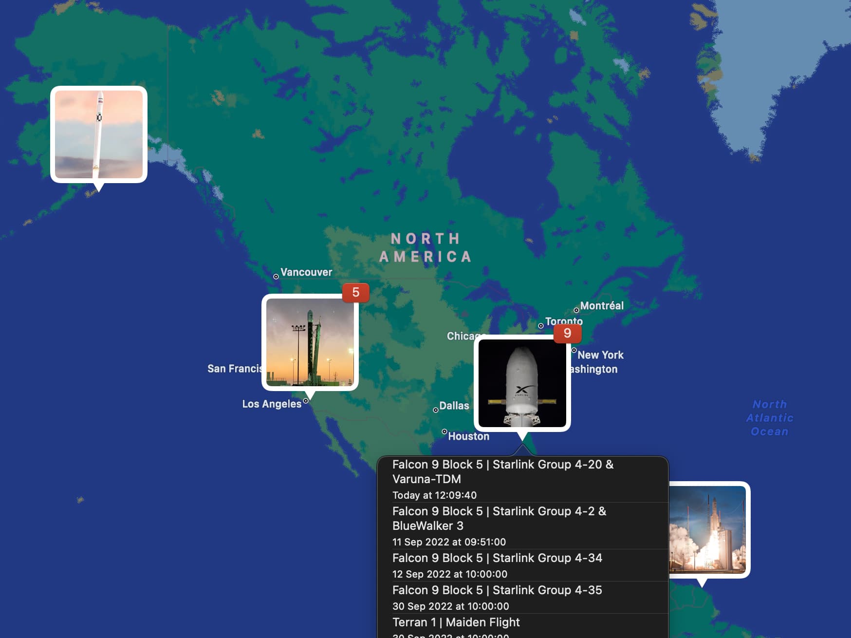
This also works with photos from remote data sets, as in the detailed “Upcoming Space Launches” gallery collection that visualises data from The Space Devs API.
Interactive Controls
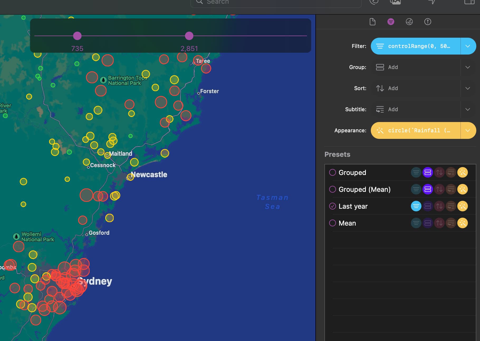
There’s a set of new formulas that adds interactive controls right in the UI, to dynamically provide a value or selection that you can then use in your formulas. Very useful for adding rich filters, or dynamic appearances. You can add multiple of these to a single preset, too.
This feature is experimental at this stage and you need to opt-in through Maparoni’s Preferences on macOS, or the Settings app on iOS.
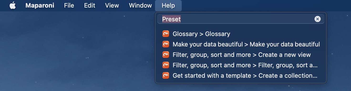
Updated User Guide
Our User Guide for beginners got a big, big update and is now a walkthrough of the various features of Maparoni. Check it out! It is also hooked-up now to the search in the Help menu in the macOS app.
And more
Check out the change log for what else is new. There’s a lot more, such as Desktop Class features and a streamlined card-based interface for iPad, cleaned-up location details for iPhone, an improved formula editor on macOS, and many, many fixes and tweaks.